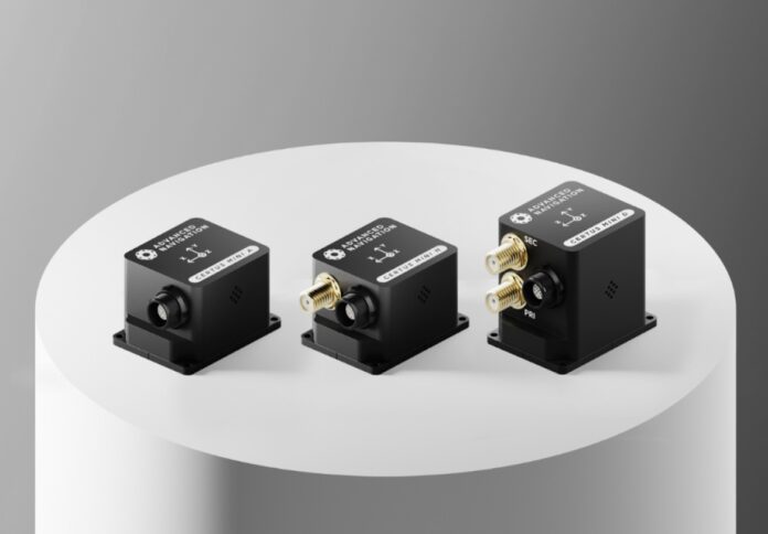
Advanced Navigation, an innovator in navigation and autonomous systems, has unveiled the expansion of its Certus range with the introduction of the new Certus Mini series.
This advanced series is designed to cater to a variety of applications and is available in three distinct variants: the GNSS-aided Certus Mini D and Certus Mini N inertial navigation systems (INS), and the Certus Mini A, which functions as an attitude and heading reference system (AHRS).
Weighing no more than 55 grams, the Certus Mini series combines performance with cost efficiency, challenging conventional expectations regarding weight and size, the company said in a media release.
Advanced Navigation CEO Chris Shaw remarked, “Manufacturers and system integrators often face trade-offs between performance, size, cost, and weight. The Certus Mini series is a testament that these attributes do not need to conflict with one another.”
Moreover, this breakthrough lowers the entry barrier for customers deploying land-based vehicles and opens new possibilities for lightweight airborne platforms like drones, where weight directly impacts flight efficiency and power consumption.
The Certus Mini series is designed for flexibility, allowing for easy integration into existing and new system builds with simple plug-and-play connectivity.
This design minimises development time and costs, making the Mini series a valuable addition to the Certus range.
The leading model, Certus Mini D, features dual-antenna GNSS heading capability.
According to the company, this model fills a critical gap in the market for a dual-antenna INS that is both lightweight and compact.
Operating on the L1/L5 multi-constellation GNSS, the Certus Mini series boasts advanced capabilities in interference immunity, position accuracy, and multipath resistance, especially in challenging urban environments.
The series incorporates Advanced Navigation’s breakthrough algorithmic technology, which provides navigation data that outperforms traditional filter methods, enhancing performance for miniature INS in GNSS-challenged conditions.
The Certus Mini series is designed for integration into both legacy systems and new builds, facilitating rapid deployment across diverse applications.
In geospatial surveying, the Certus Mini can augment drone solutions, offering positioning and attitude without adding significant weight.
This capability enables applications across open-pit mines, construction sites, urban areas, and critical infrastructure.
In the agriculture sector, the Certus Mini can be integrated into purpose-built robots and equipment for various tasks, including aerial spraying, weed detection, monitoring crop health, and creating field maps.
It also finds utility in open-pit mining, providing precise rig alignment for surface drilling OEMs and integrators, even in deep pits where multipath errors are prevalent.
Moreover, the Certus Mini can facilitate asset tracking across industries such as mining, facility management, manufacturing, and construction.


